Tracing US Imperialism: A Comprehensive Historical Map Guide
Understanding the United States’ imperial past requires more than a list of dates; it demands a visual and contextual exploration of how the nation’s territorial ambitions reshaped the world. This guide examines key phases of American expansion, each illustrated through cartographic evidence that underscores the geopolitical shifts and policy decisions defining US imperialism.
1. Louisiana Purchase (1803)
The 1803 acquisition doubled the size of the young republic, adding 828,000 square miles of territory from France. Cartographers of the era immediately updated maps to reflect the new borders, demonstrating the United States’ growing confidence in its continental reach and setting a precedent for future acquisitions.
2. Manifest Destiny and the Oregon Trail (1830‑1846)
By the mid‑19th century, American settlers and policymakers embraced the doctrine of Manifest Destiny, believing it was their destiny to spread across the continent. Maps from this period highlight the route of the Oregon Trail and the annexation of the Oregon Territory, showcasing the nation’s expansionist mindset and the federal government's role in supporting westward migration.
3. Mexican–American War and the Gadsden Purchase (1846‑1853)
Cartographic records of the Mexican–American War depict the rapid annexation of present‑day California, Nevada, Utah, Arizona, and New Mexico. Later, the 1853 Gadsden Purchase added southern Arizona and New Mexico, illustrating how diplomatic negotiations and military victories combined to reshape the national map.
4. Alaska Purchase (1867)
Often called “Seward’s Folly,” the 1867 purchase from Russia added a vast, resource‑rich territory to the United States. Maps from the era show Alaska’s dramatic extension to the far north, emphasizing the U.S. government's strategic interests in securing Arctic access and securing natural resources.
5. Spanish–American War and Puerto Rico (1898)
Following the 1898 conflict with Spain, U.S. forces seized Puerto Rico and the Philippines. Updated maps illustrate the archipelago’s addition to the American sphere, highlighting a shift from continental expansion to overseas territorial control.
6. Philippine–American War (1899‑1902)
Cartographic evidence from this conflict showcases the United States’ occupation and governance of the Philippines. The maps illustrate how U.S. military forces established strategic positions across the archipelago, underscoring the country’s emerging role as a colonial power.
7. U.S. Naval Base at Guam (1899)
Guam’s annexation during the Spanish–American War is clearly marked on contemporary maps, demonstrating the United States’ strategic maritime ambitions in the Pacific. The island’s placement on naval charts underscored its importance as a coaling station and later as a modern naval base.
8. Panama Canal Zone (1904‑1979)
While the U.S. never formally annexed Panama, it maintained control over the Panama Canal Zone. Maps from the early 20th century display the canal’s boundaries and the surrounding U.S. military installations, illustrating the nation’s investment in global trade routes and strategic dominance.
9. U.S. Support for the Dominican Republic (1916‑1924)
Cartographic records of the U.S. occupation of the Dominican Republic reveal the U.S. intervention’s geographic scope, with maps highlighting U.S. military zones and administrative divisions. This period exemplifies America’s use of military power to influence political outcomes beyond its borders.
10. Cold War Era Containment and the Marshall Islands (1959‑1988)
During the Cold War, the U.S. established a presence in the Marshall Islands, eventually forming the Compact of Free Association. Maps from the era delineate U.S. military installations and show the islands’ strategic position in the Pacific, illustrating how imperial strategy evolved to counter Soviet influence.
American Imperialism Map

American Imperialism Map
Map Of American Imperialism
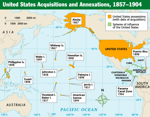
Map Of American Imperialism
Imperialism Modern World 1900 Map » Shop U.S. & World History Maps

Imperialism Modern World 1900 Map » Shop U.S. & World History Maps ...
Map Of American Imperialism

Map Of American Imperialism
Map Of American Imperialism
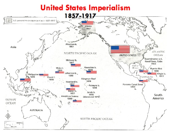
Map Of American Imperialism
U.S. Imperialism (Google Drive/Distance Learning/Imperialism Map)

U.S. Imperialism (Google Drive/Distance Learning/Imperialism Map)
Us Imperialism Outline Map Mapping The American Revolution And Its Era

Us Imperialism Outline Map Mapping The American Revolution And Its Era
American Imperialism Map
American Imperialism Map
Essential Unit Maps - AP US History

Essential Unit Maps - AP US History
American Imperialism 19th Century Map

American Imperialism 19th Century Map
US Imperialism Map

US Imperialism Map
American Imperialism Map Activity (Google Comp) By The Patriot Resource

American Imperialism Map Activity (Google Comp) by The Patriot Resource
American Imperialism Map

American Imperialism Map
Map Of American Imperialism
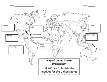
Map Of American Imperialism
American Imperialism Map Worksheet By Ace Up Your Sleeve | TPT

American Imperialism Map Worksheet by Ace Up Your Sleeve | TPT
American Imperialism Map

American Imperialism Map
Imperialism Maps - Mrs. Kelly History Exploration

Imperialism Maps - Mrs. Kelly History Exploration
American Imperialism Map
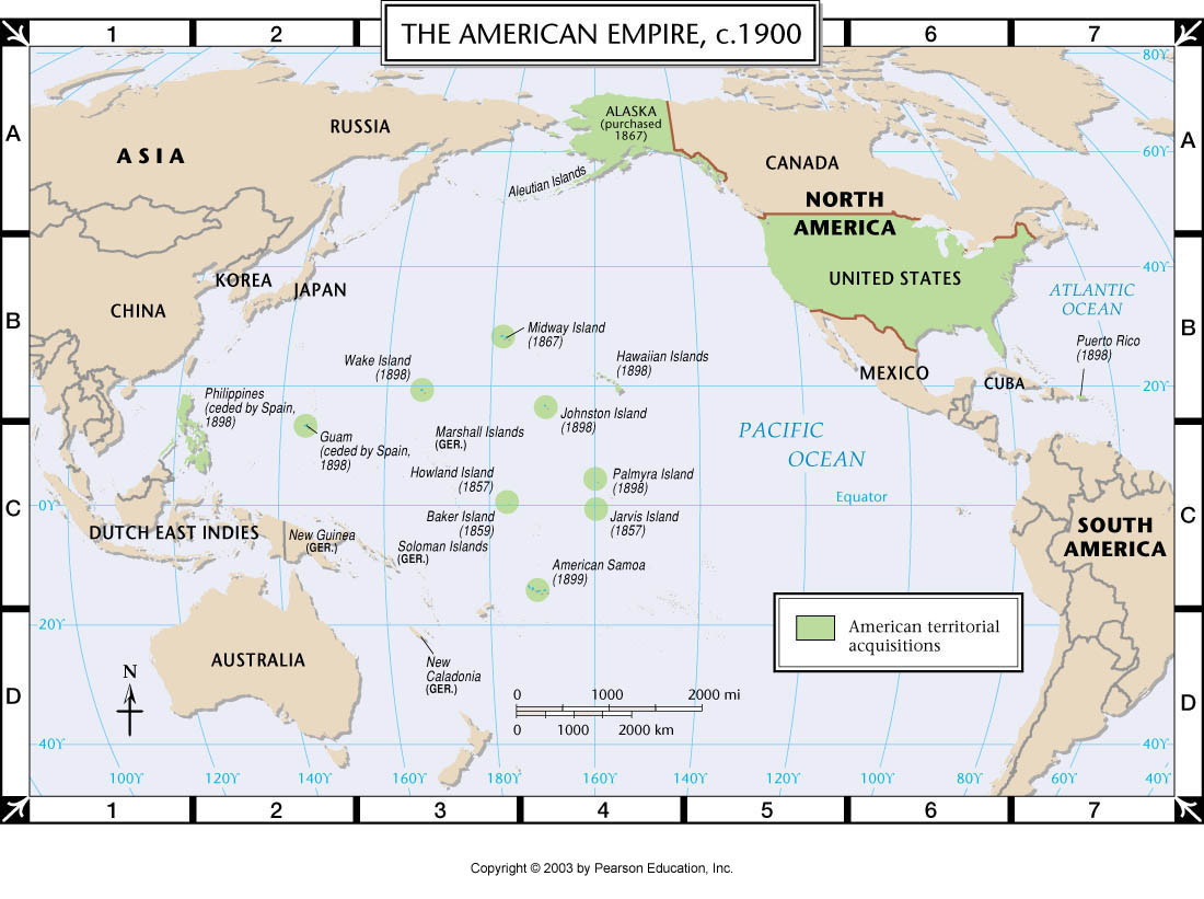
American Imperialism Map
American Imperialism Map - Labelled Diagram

American Imperialism Map - Labelled diagram
Map View: US Imperialism

Map View: US Imperialism
Imperialism Map 1914

Imperialism Map 1914
Us Imperialism Outline Map Mapping The American Revolution And Its Era

Us Imperialism Outline Map Mapping The American Revolution And Its Era
Crossen Playing Blogger -- Email: Dcrossen@njuhsd.com: US History

Crossen Playing Blogger -- Email: dcrossen@njuhsd.com: US History ...
American Imperialism Map Activity – XNNHNC
American Imperialism Map Activity – XNNHNC
Imperialism Map Caribbean Sea Maps (Cuba, North America) Collection

Imperialism Map Caribbean Sea Maps (Cuba, North America) Collection
American Imperialism 19th Century Map

American Imperialism 19th Century Map
American Imperialism Map – US Imperialism Map QuizAmerican Imperialism

American Imperialism Map – US Imperialism Map QuizAmerican Imperialism ...
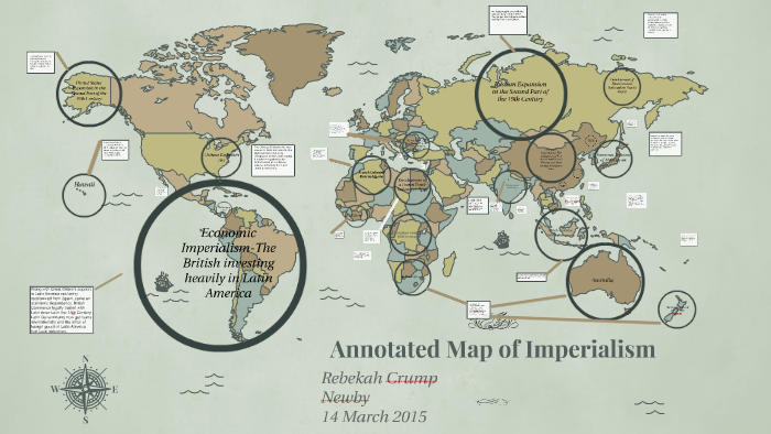
Imperialism Map Project Alexis By Alexis On Prezi

Imperialism Map Project Alexis by Alexis on Prezi
American Imperialism 19th Century Map
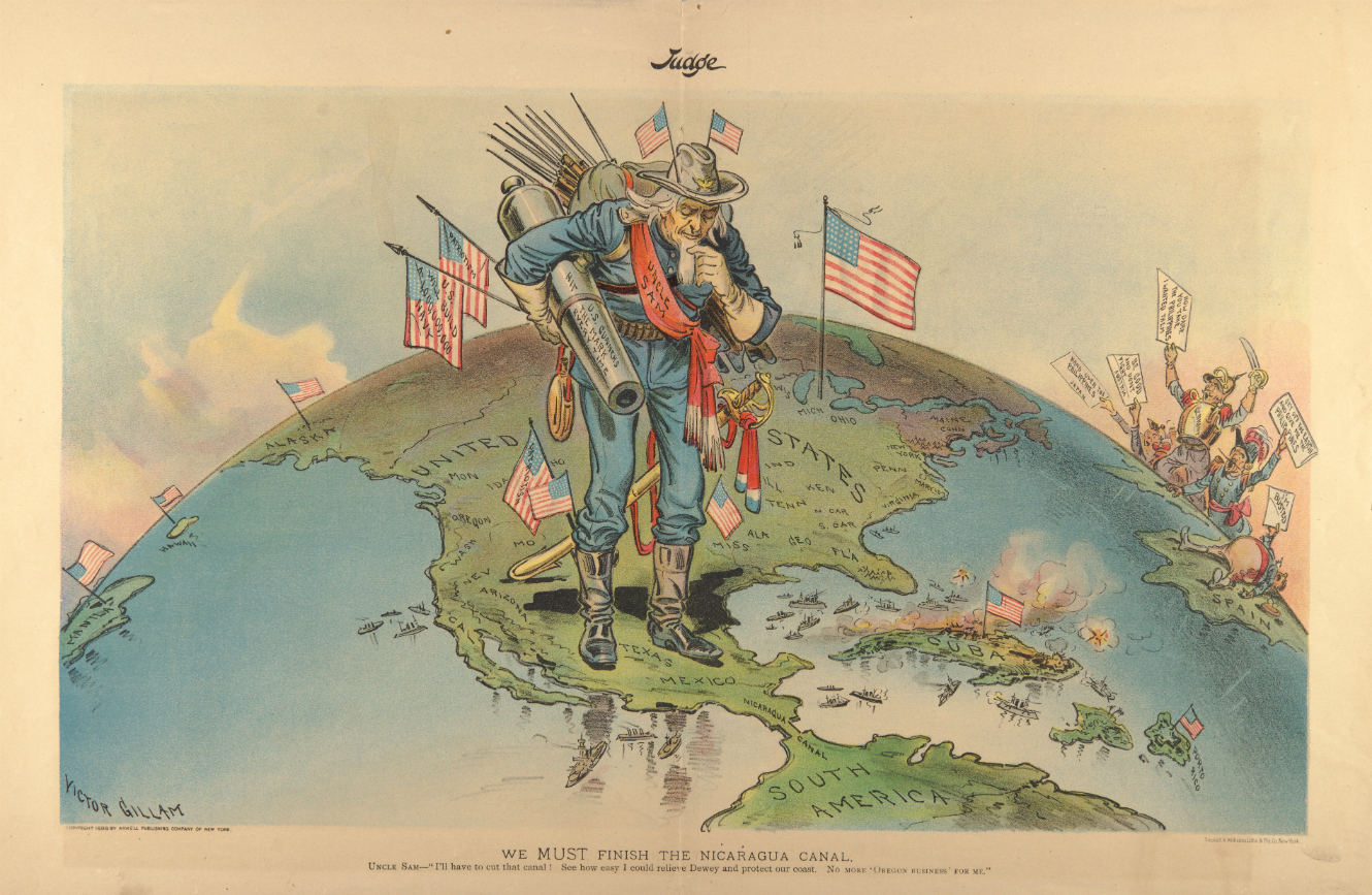
American Imperialism 19th Century Map
US Imperialism Map Project - Honors US History II By Wataru Coram On Prezi

US Imperialism Map Project - Honors US History II by Wataru Coram on Prezi
American Imperialism Map Activity (Google Comp) By The Patriot Resource
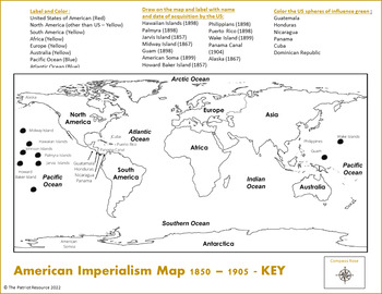
American Imperialism Map Activity (Google Comp) by The Patriot Resource
US Imperialism Map - Labelled Diagram

US Imperialism Map - Labelled diagram
